Split – Vis (6-4-19)
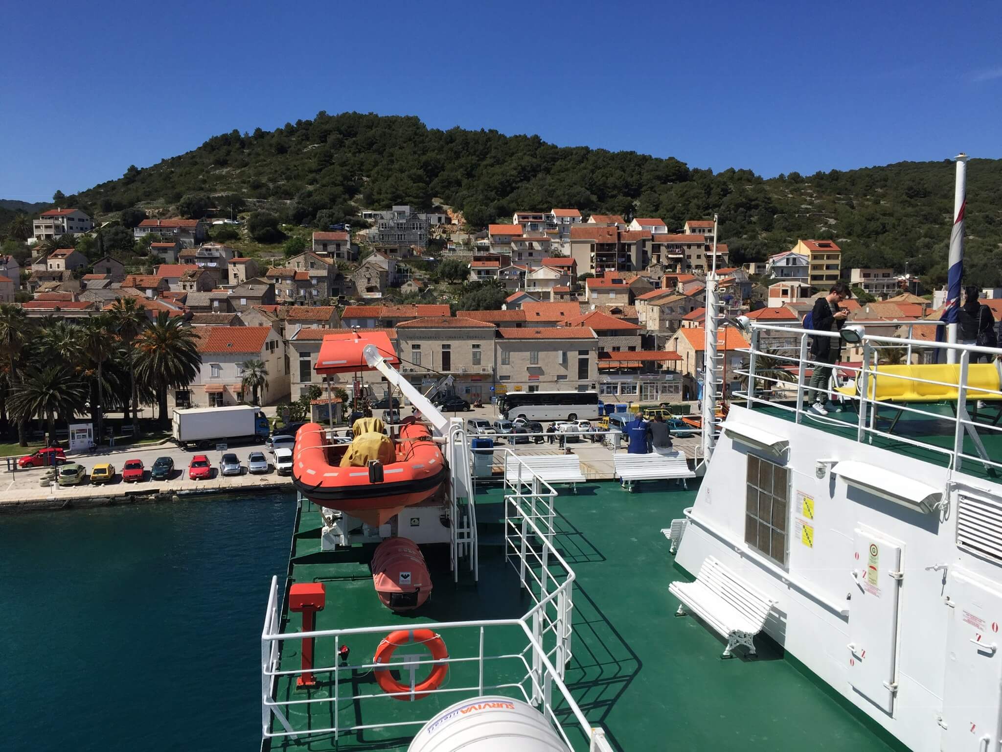
Today I am leaving Split for the Island of Vis, Croatia. I learned that Vis is the most remote, permanent inhabited island in Croatia. Saying that, it takes only a bit more than 2 hours to reach Vis by big (and slow) vessel. Leaving Split by this ferry is an experience on it’s own. Sailing off and turning the vessel in the harbour, is a slow process which gives you enough time to enjoy the beautiful panoramic view over the city, especially from the upper decks.
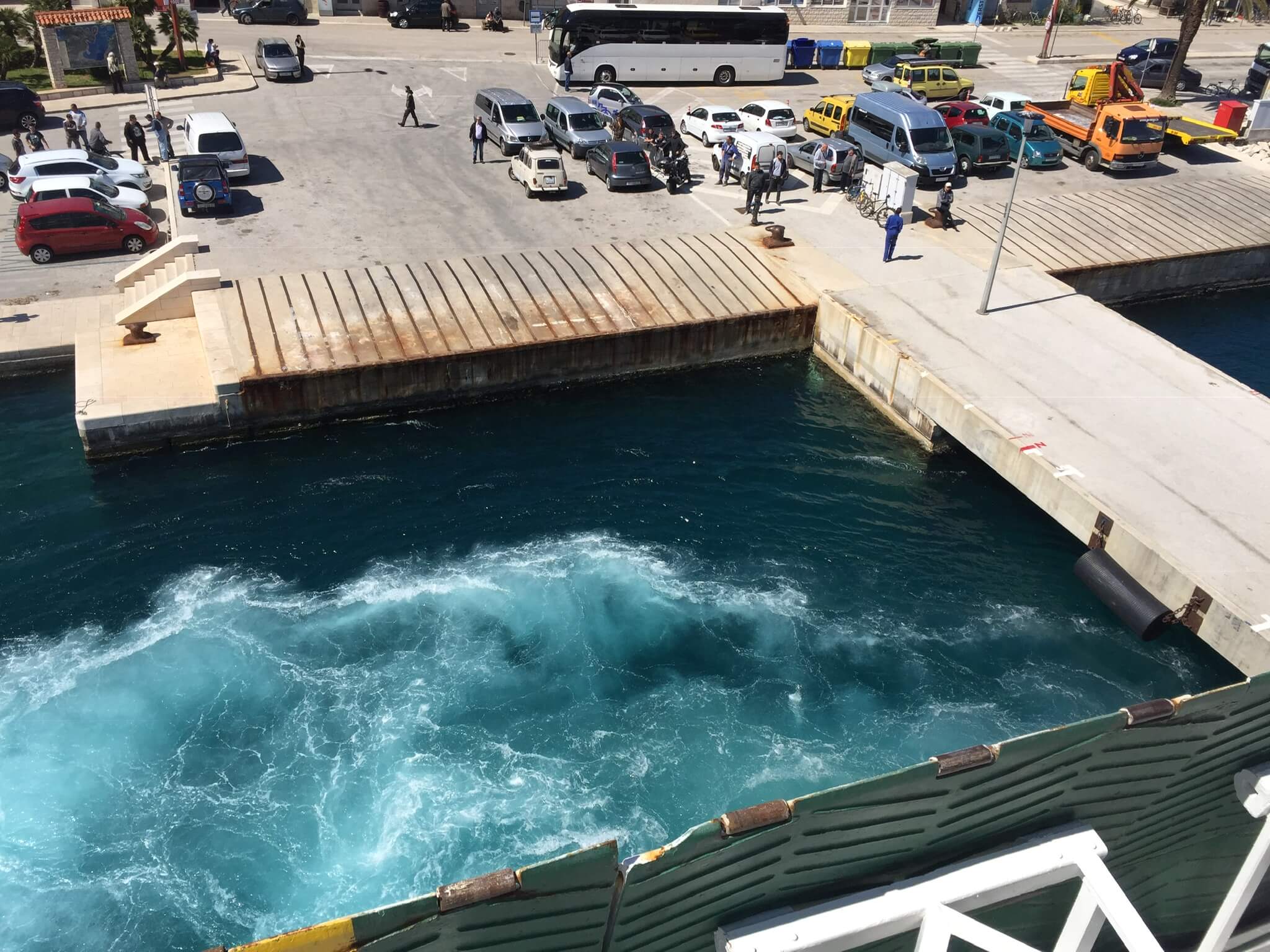
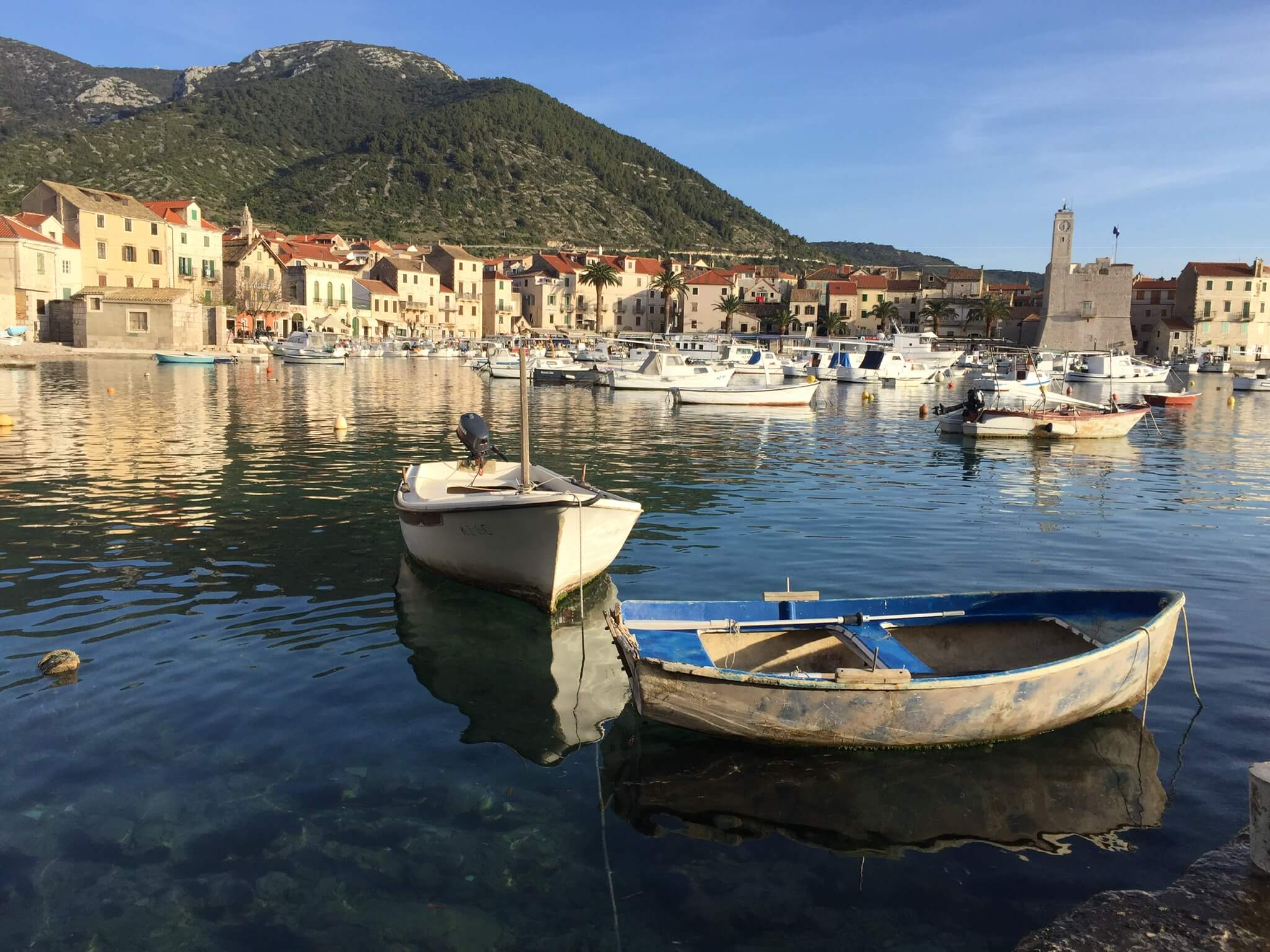
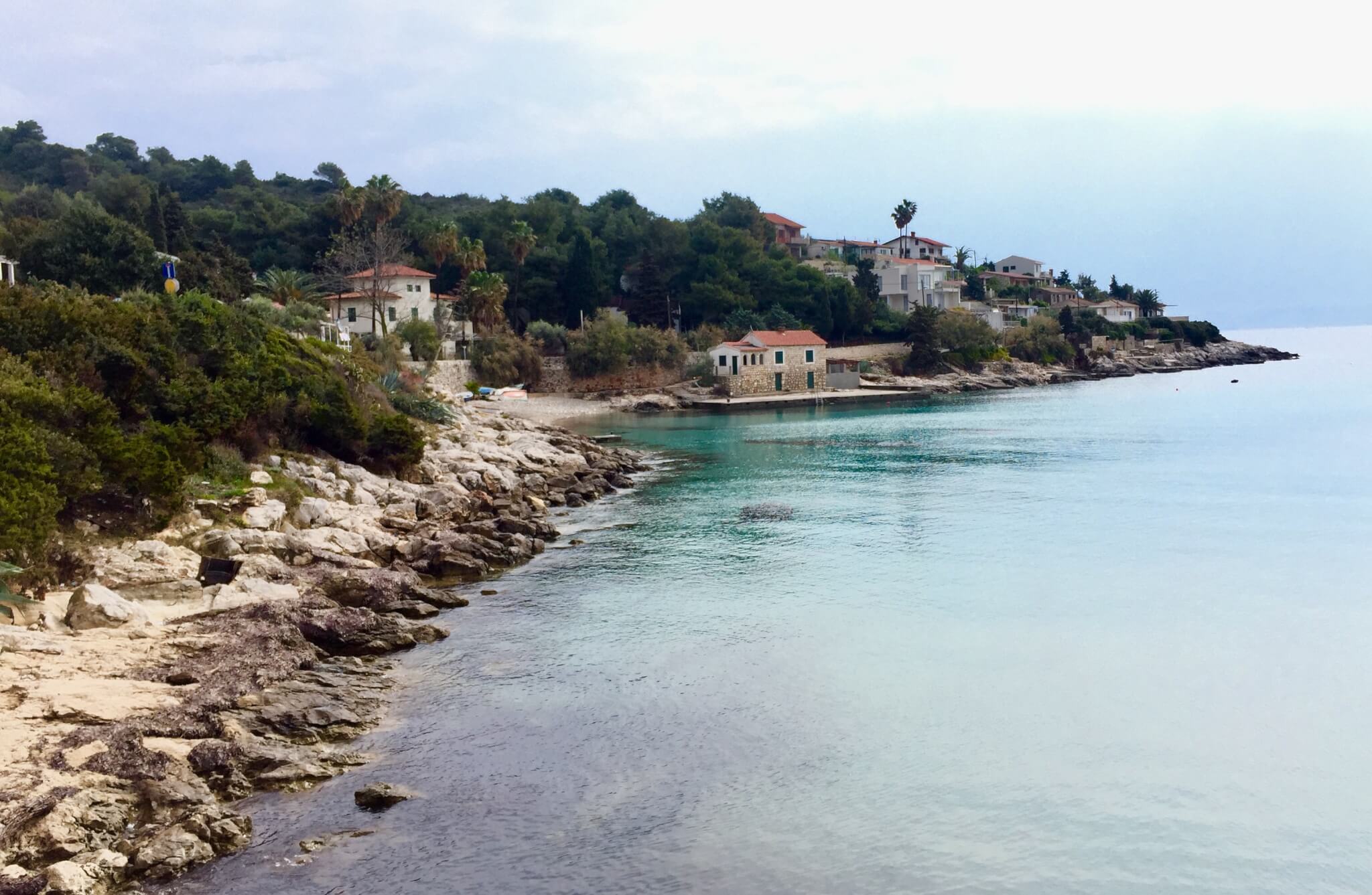
The ferry passes the narrow straight between the islands of Solta and Brac and then passes Hvar island on the way to Vis. The approach of Vis island is beautiful. The town of Vis is situated in a horseshoe shaped bay, with quiet waters and a beautiful water front, with a mountainous background. As the cars on this car ferry drove in at the front site, the ship needs to make a turn and reverse towards the dock (in order to avoid that the motorists have to reverse their cars out of the ship). This process is also an experience in this small and gorgeous looking bay.
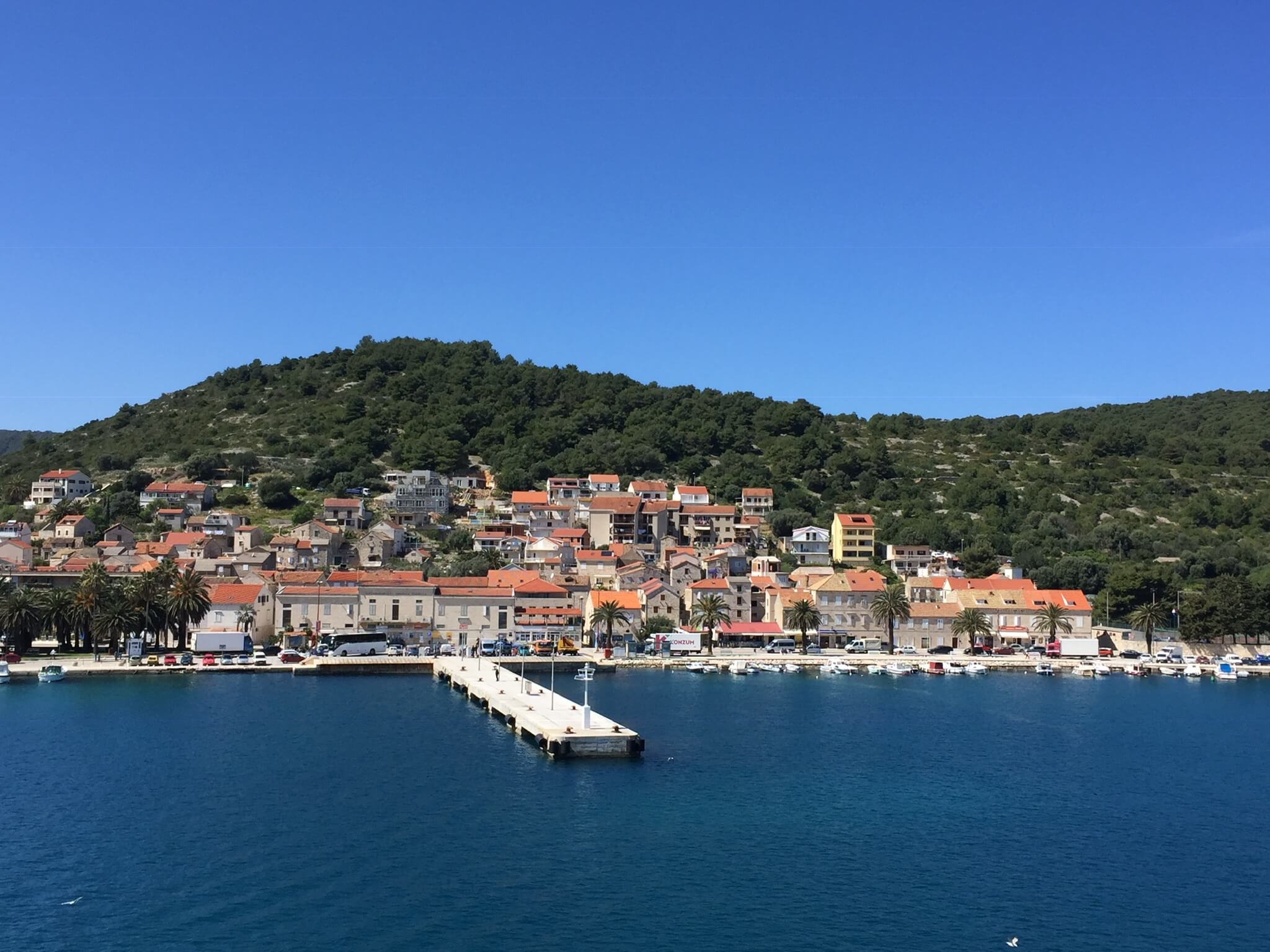
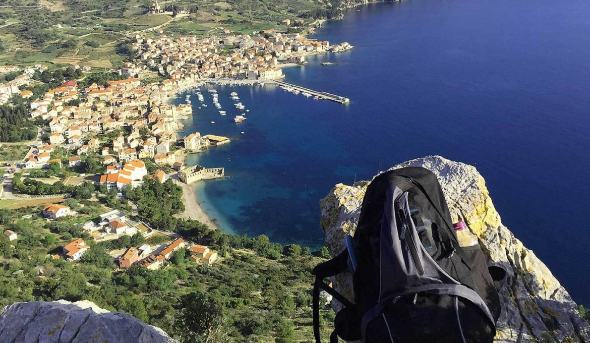
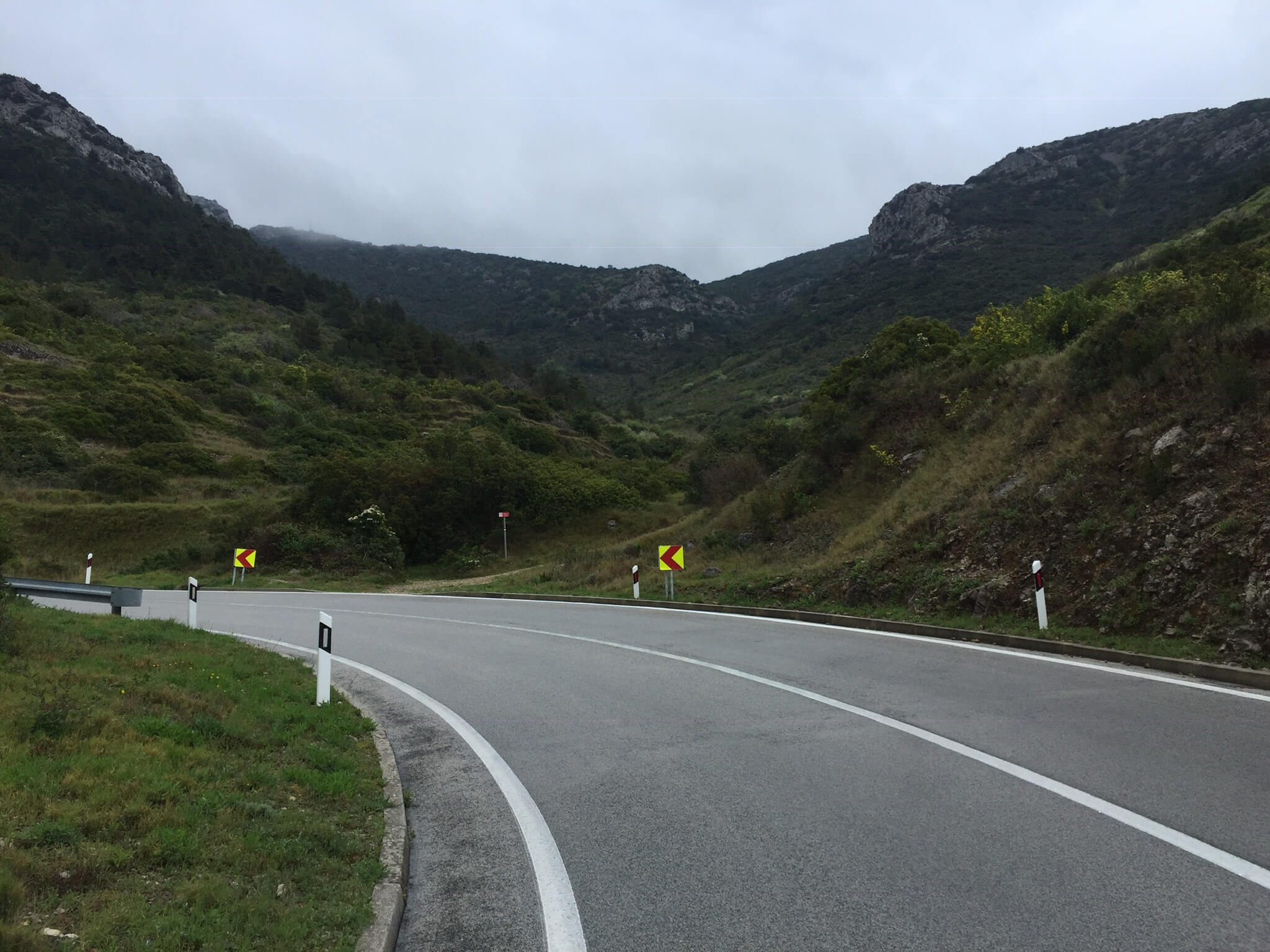
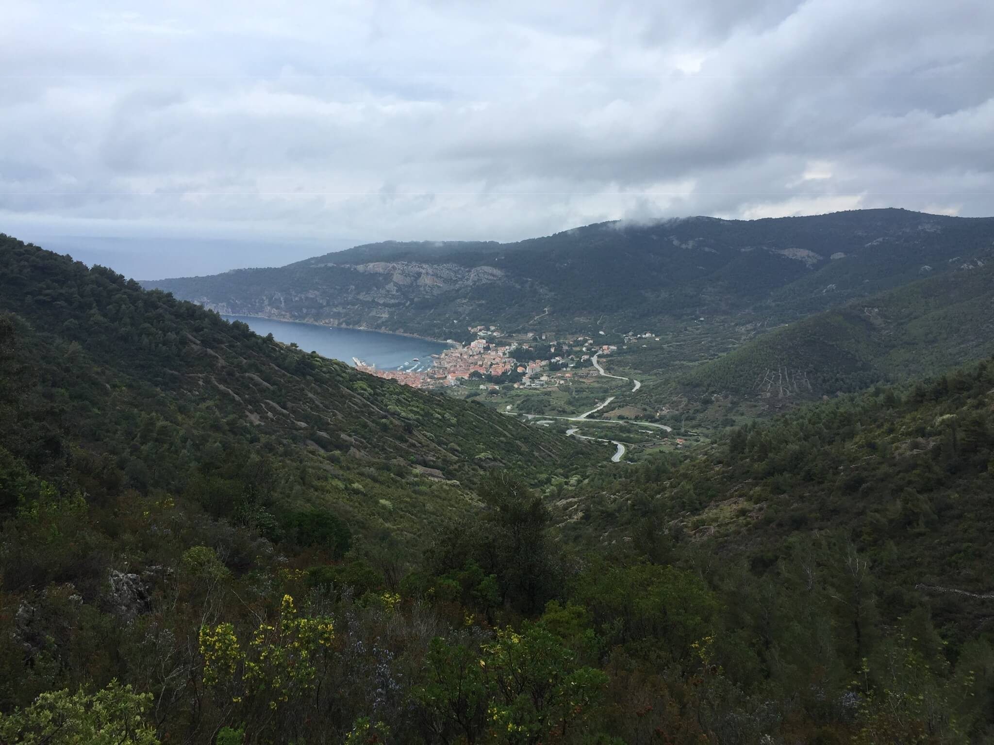
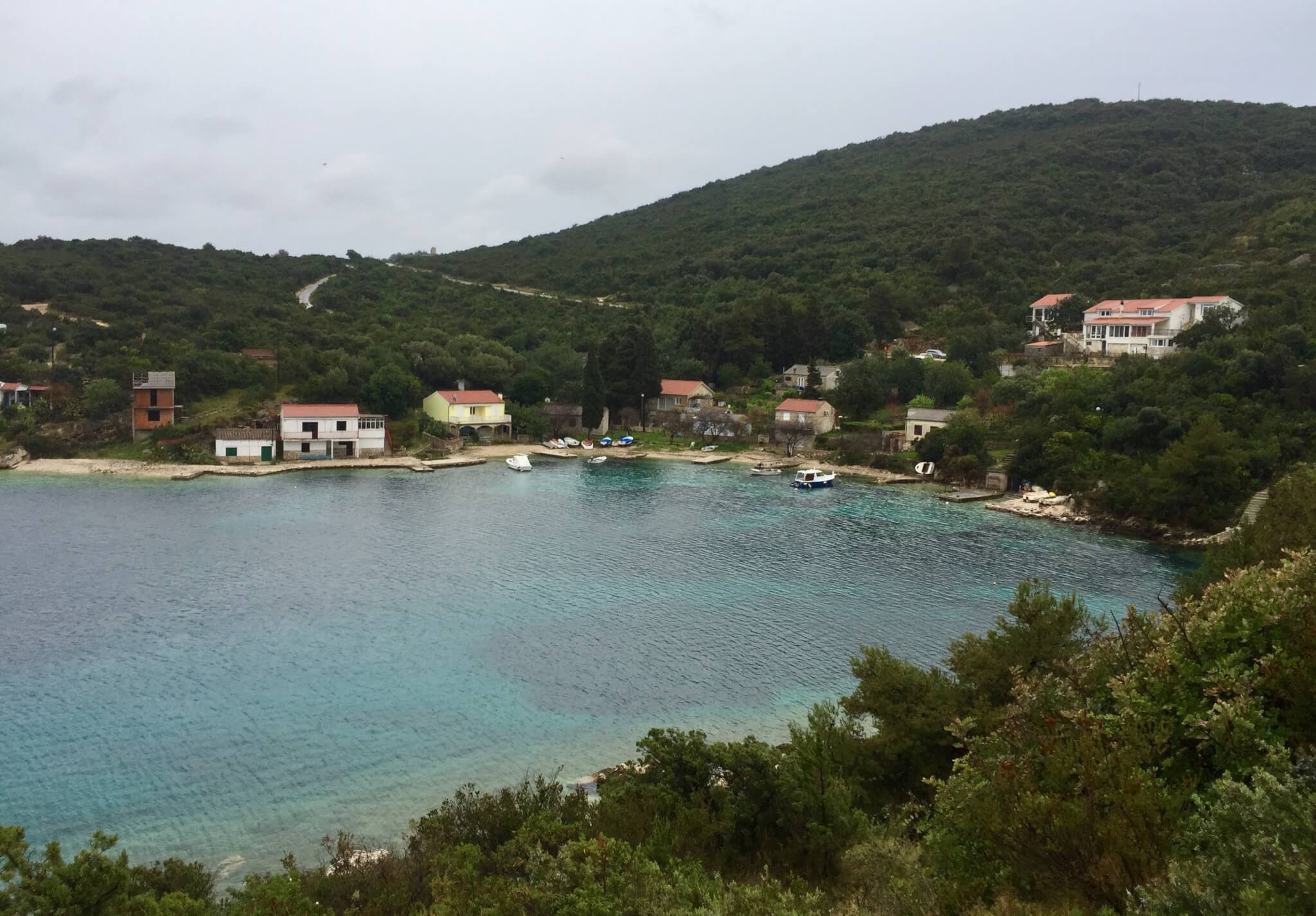
Vis has 2 towns of significance; Vis Town and Komiza. My destination for today and tomorrow is Komiza, on the other side of the island. Fortunately buses on this island are serving the ferry, so i didn’t have to walk far, or wait long, to get to Komiza. The town of Komiza is divided from the rest of the island by a mountain range called Hum, with a road full of hairpin turns, where you will be treated with a beautiful view over Komiza and its bay.
In a way the approach to, and the remoteness of, this town reminds me of the town of Pollara on the island of Salina, one of the Aeolean islands. The scenery is less dramatic, but the fact that it is on the far site of the island and, apart from 2 winding roads, almost cut off from the rest of the island makes the comparison.
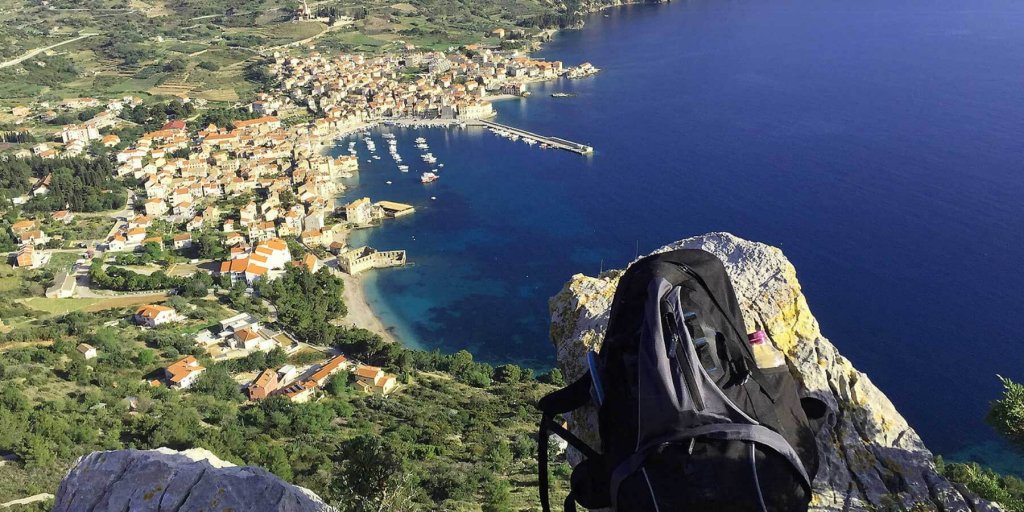
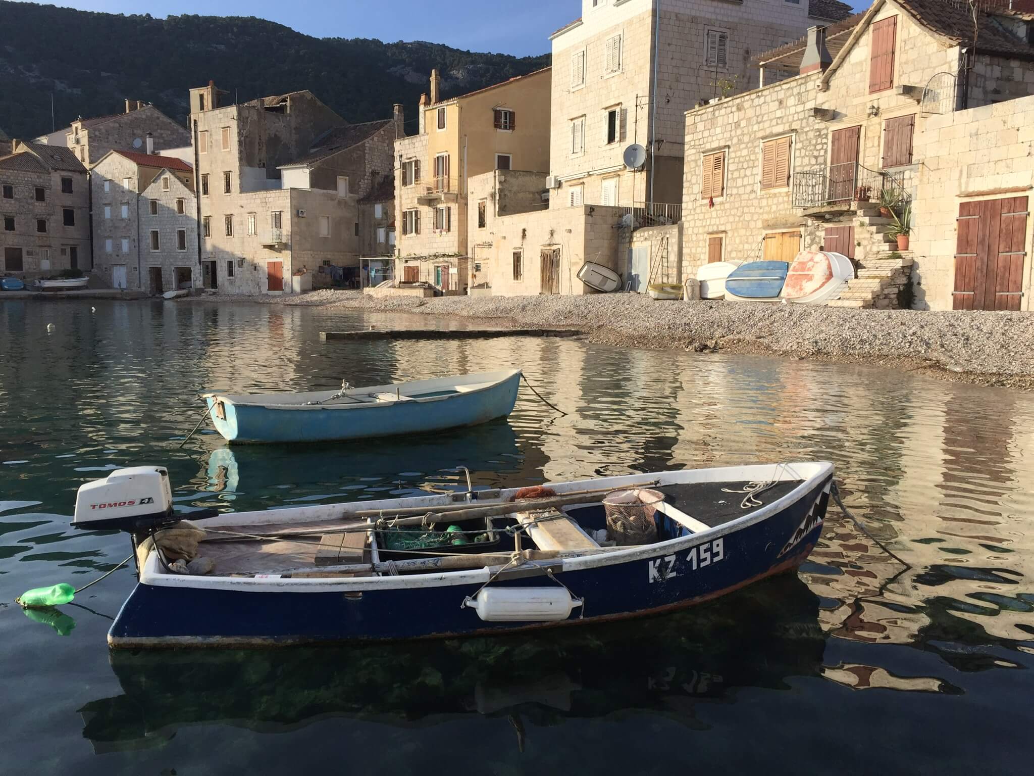
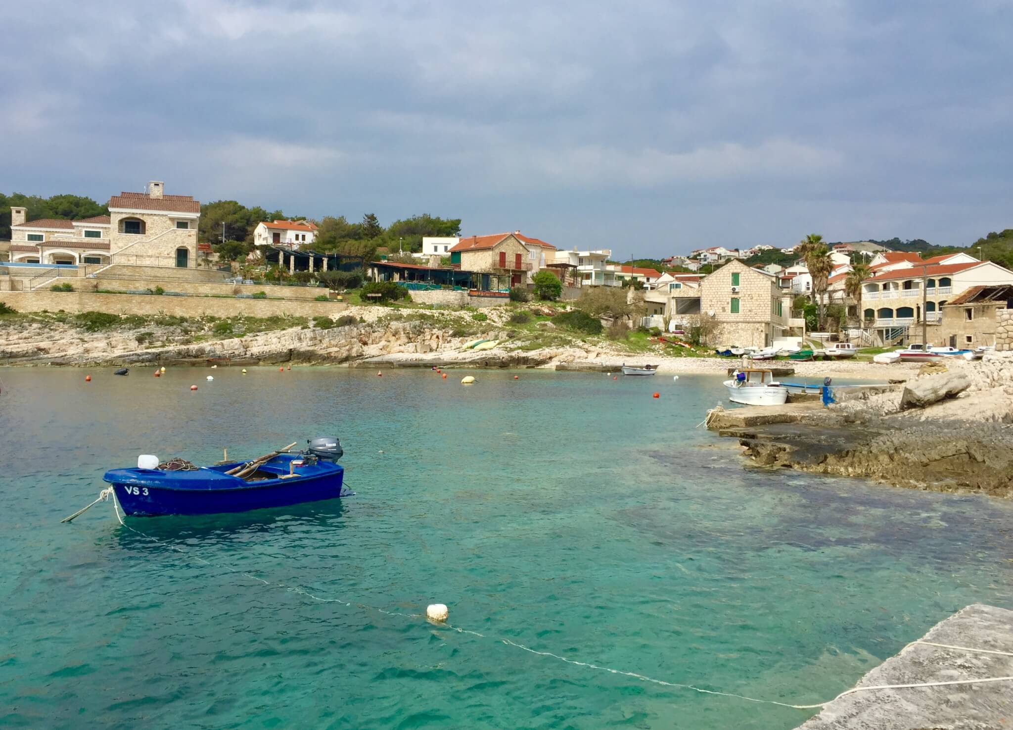
Especially with todays sunny weather this town looks marvelous! Very Idyllic, with a lovely waterfront, old houses(some right at the water‘s edge) clear water and small boats spread out in the small harbour. From Komiza you can hike up to the church of Blaz (altitude 239 meters). From this track you get a fantastic view over Komiza and its bay.
Behind the church you can continue to the deserted village of Dragodid. You literally cross this set of abandoned houses and sheds to follow the track down to, from where you have a view to the 2 tiny islands of Barjak, before turning back to Komiza. The whole trail is easily accessible and takes about 2 hours (without stops).
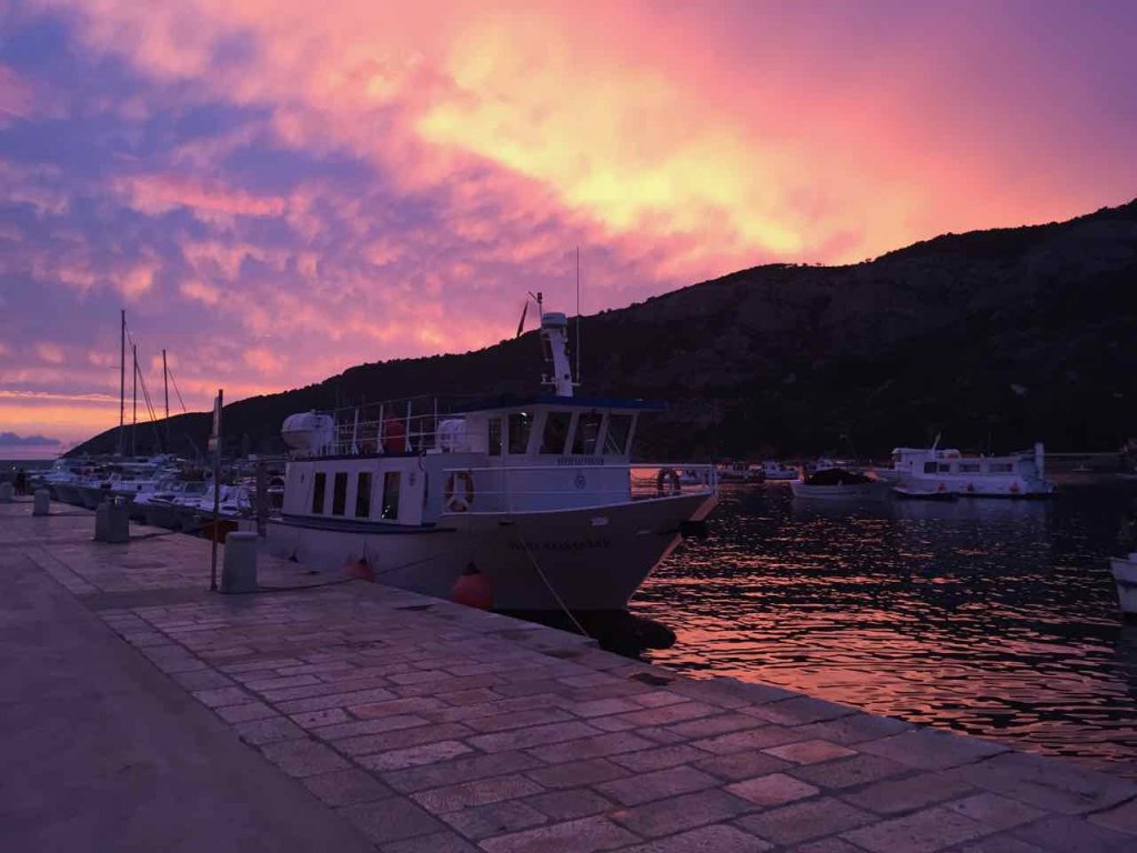
At this time of the year, there are only two (Italian) restaurants open in Komiza. Both good, and nice places to watch the sunset. But unfortunately this beautiful sky tells us something: Rain tomorrow 🙁
Hiking Komiza to Vis (7-4-19)
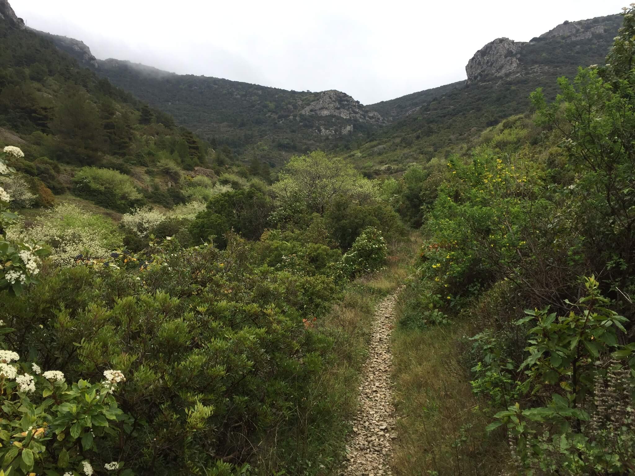
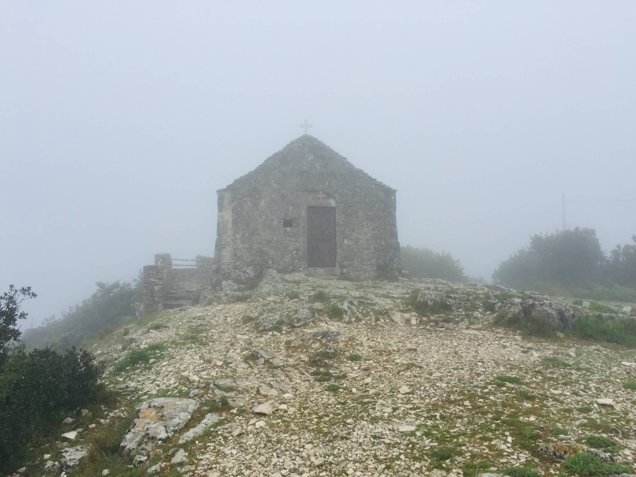
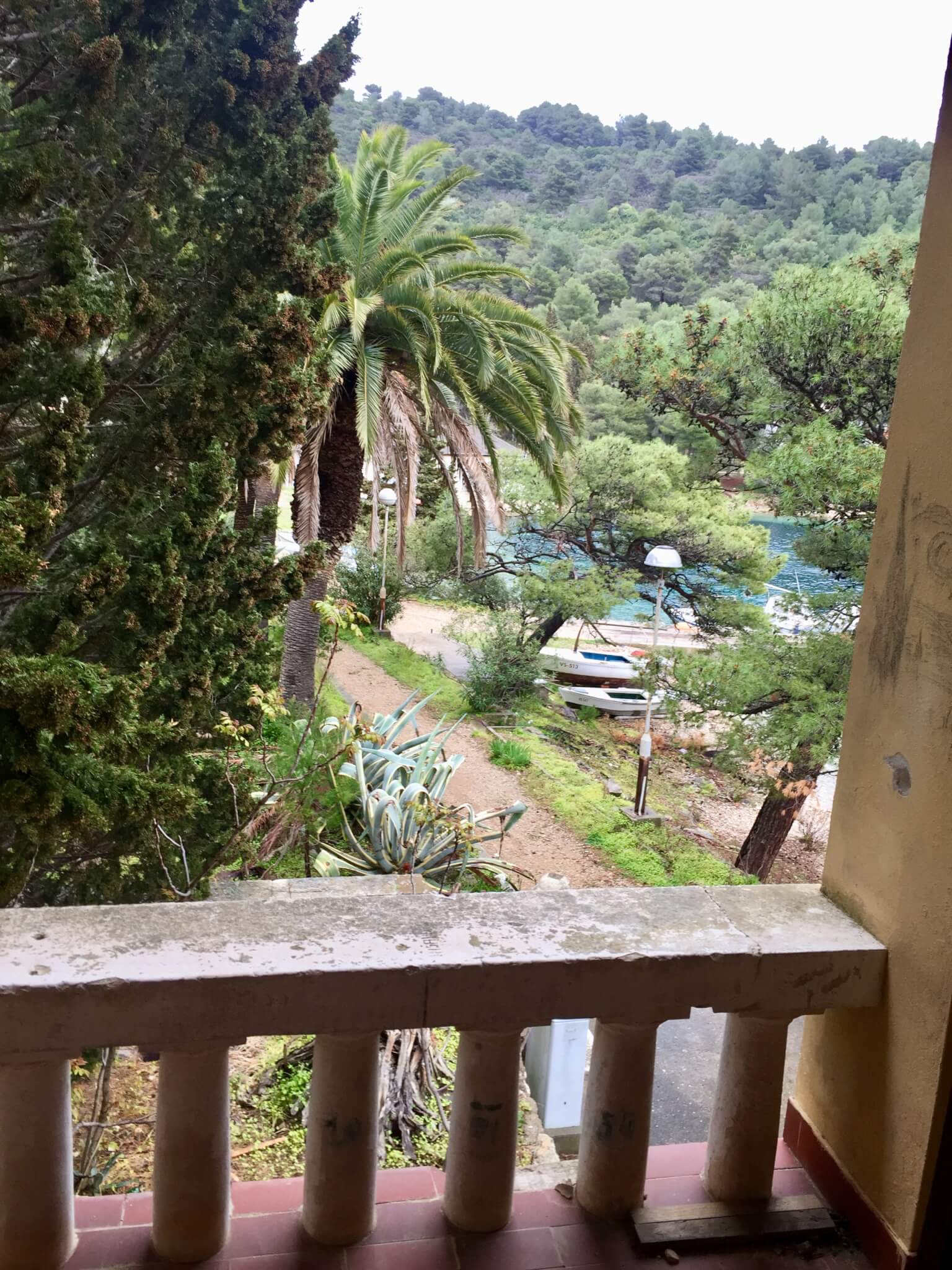
Although the accomodation where I am staying (Kod Senke) is beautiful, on this cloudy and rainy day i didn’t want to be locked up inside. So i decided to take the hiking track towards Sveti Duh on the Hum mountain. From Komiza it’s a good 20 minutes hiking along the main road (towards Vis town), before you get to a turn-off point on the right with a red sign ‘Hum’. This winding and sloping track is long and small, but accessible and not too difficult. It goes through green and open bush and you also get a good view of Komiza. From the main road it takes an experienced hiker, like me, about an hour to get to the little chapel of Sveti Duh (564 m.).
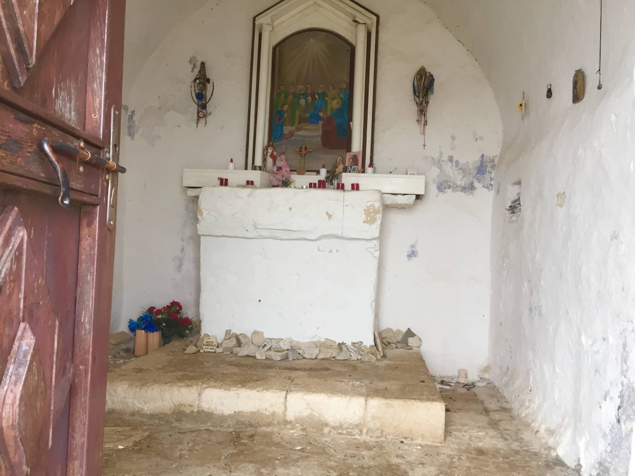
The mist on top makes the scene a little mysterious, but to my surprise, the door of the chapel wasn’t locked. Opening the door gave a complete contrast to the misty world outside. A colorful mix of candles, miniature statues, flower, necklaces, bracelets, written letters and water bottles filled the tiny room. And for me it was also a peaceful shelter against the wind and fog.
I continued the official hiking trail towards Vis. The good thing about hiking the route in this direction (Komiza to Vis) is that once you’ve reached Sveti Duh, almost on the top of Hum mountain, the climbing is basically over. From this point, the rest of the track to Vis takes about two hours (without stops) and slowly descends. The route is well marked with red and white dots or stripes.
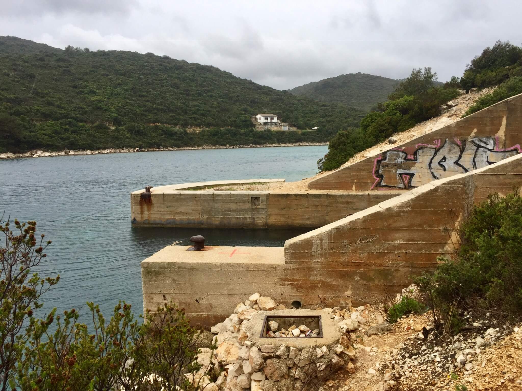
A very interesting site, about 100 meters from the track, are the caves close to Velika Glava. It’s unmarked, as a lot of former military sites here. But a concrete block, sticking out of the ground caught my attention. When I came closer I noticed an opening in the rock wall, where you can walk in without climbing or bending. Inside is a tunnel system with concrete walls and doorless rooms on either site. Because i was just by myself, and only had a small torch with me, i didn’t go further than about 30 meters, but from here the tunnel system seemed to go on and on.
From here, it’s about an hour of fairly easy walking to the town of Vis, where i ordered a coffee at the bakery and took the (not so frequent, but coincidentally joining) bus back to Komiza.
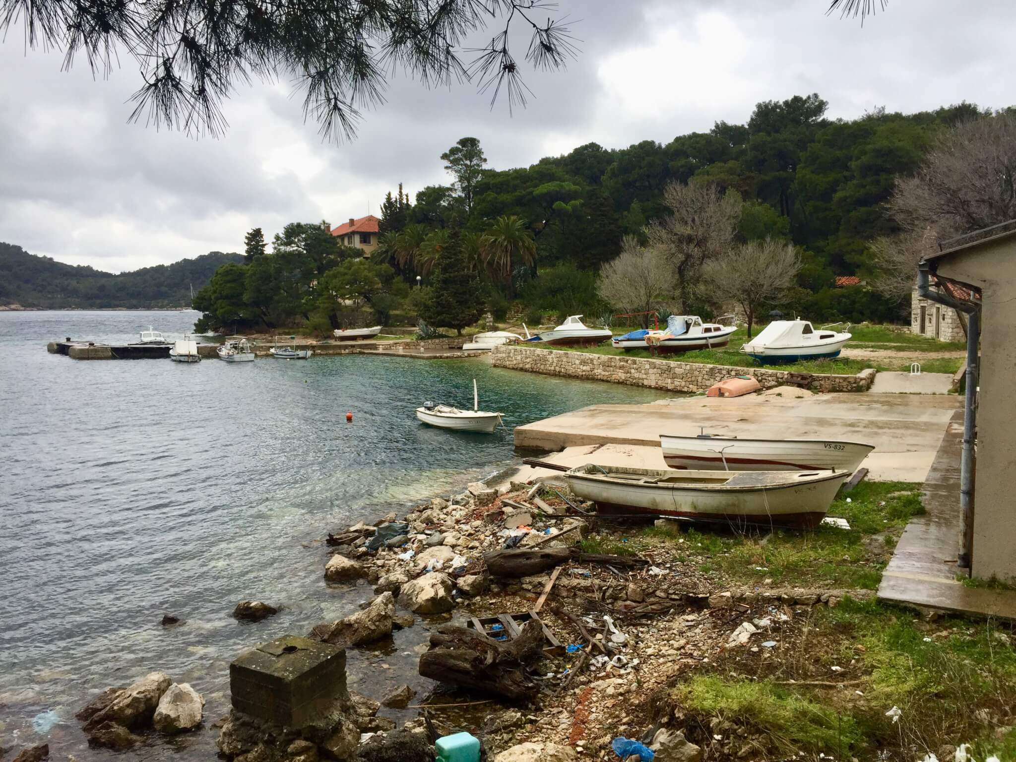
Exploring the bay around Vis town (8-4-19)
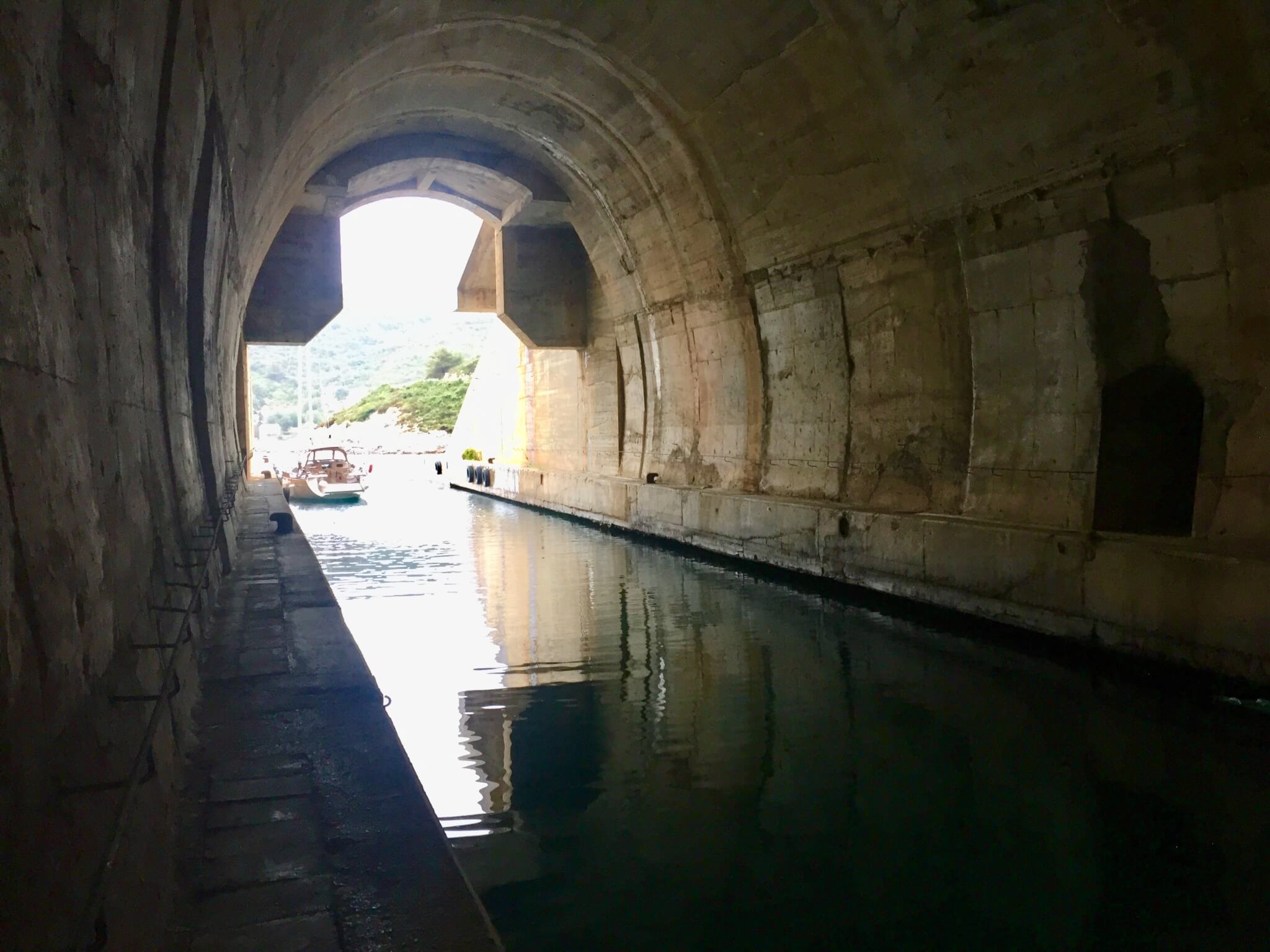
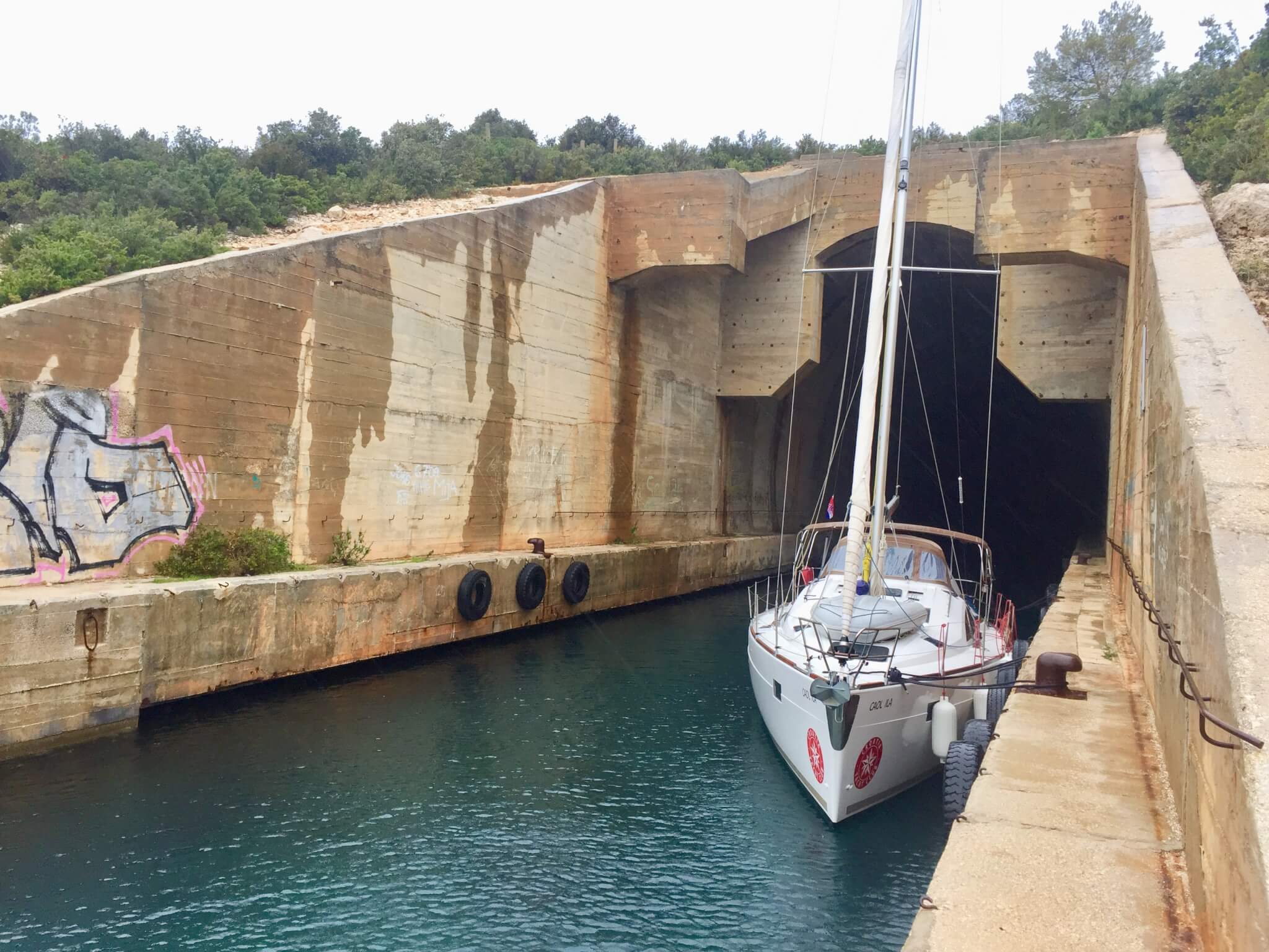
Today i take the early morning (6.30) bus from Komiza to Vis. At 9 o’clock i have an appointment with the tourist office in Vis Town. That gives me just enough time to explore the bay area north of town. In history, Vis had been occupied by different nations. One of the remains in this area is George Castle, build by te Britts. And due to it’s strategic as well as isolated position, Vis was used as a military base in the second half of the 20th century. A very impressive and obvious example of this is the former submarine base. From photos on the internet I knew this is on Vis, but didn’t know where it was, because you don’t find much information about it’s position. But, as a surprise to me, it turned out to be in Parja bay at the end of the 3 km tarmac road i took from Vis Town A scenic and enjoyable walk, even in the rain.
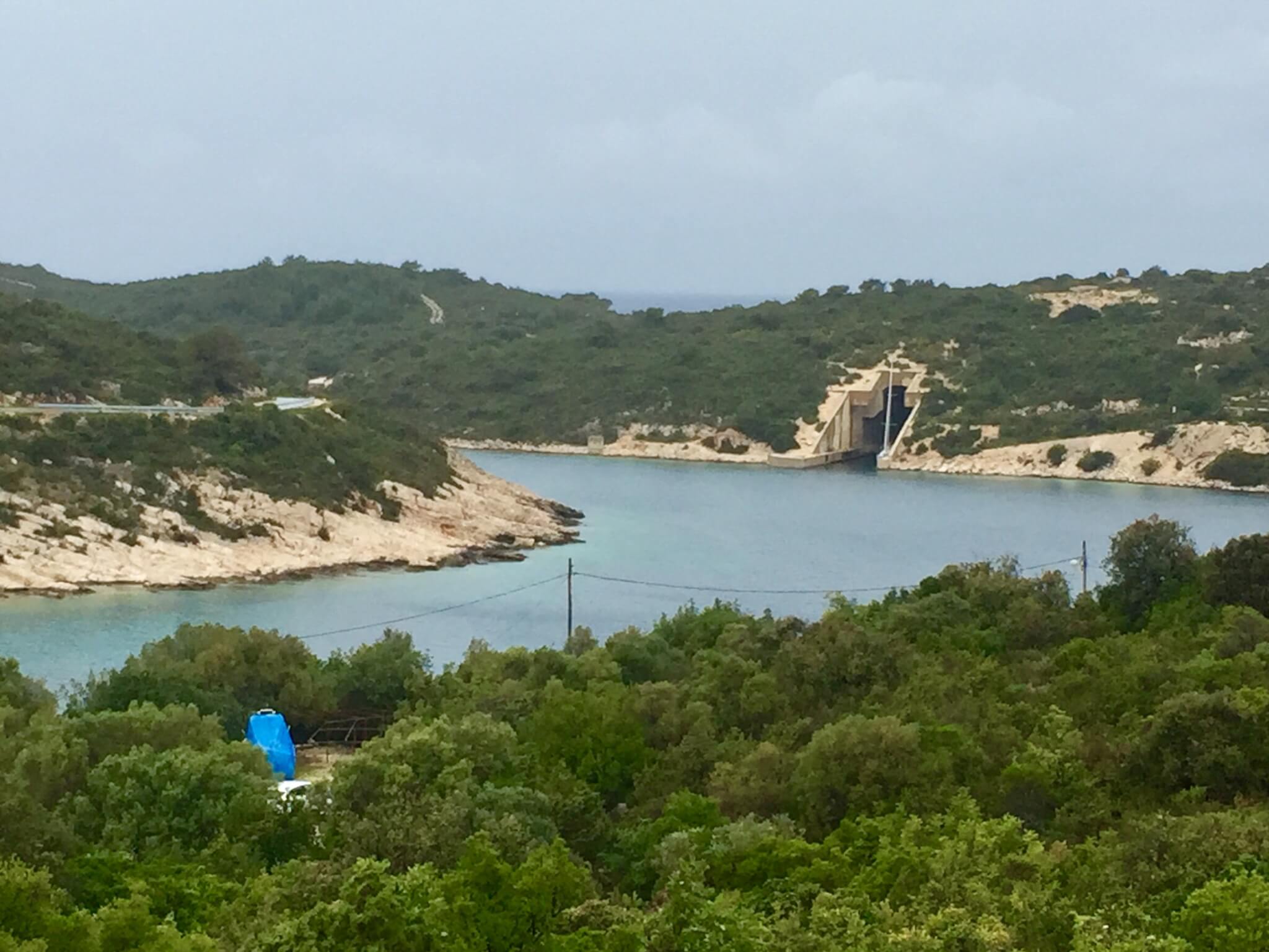
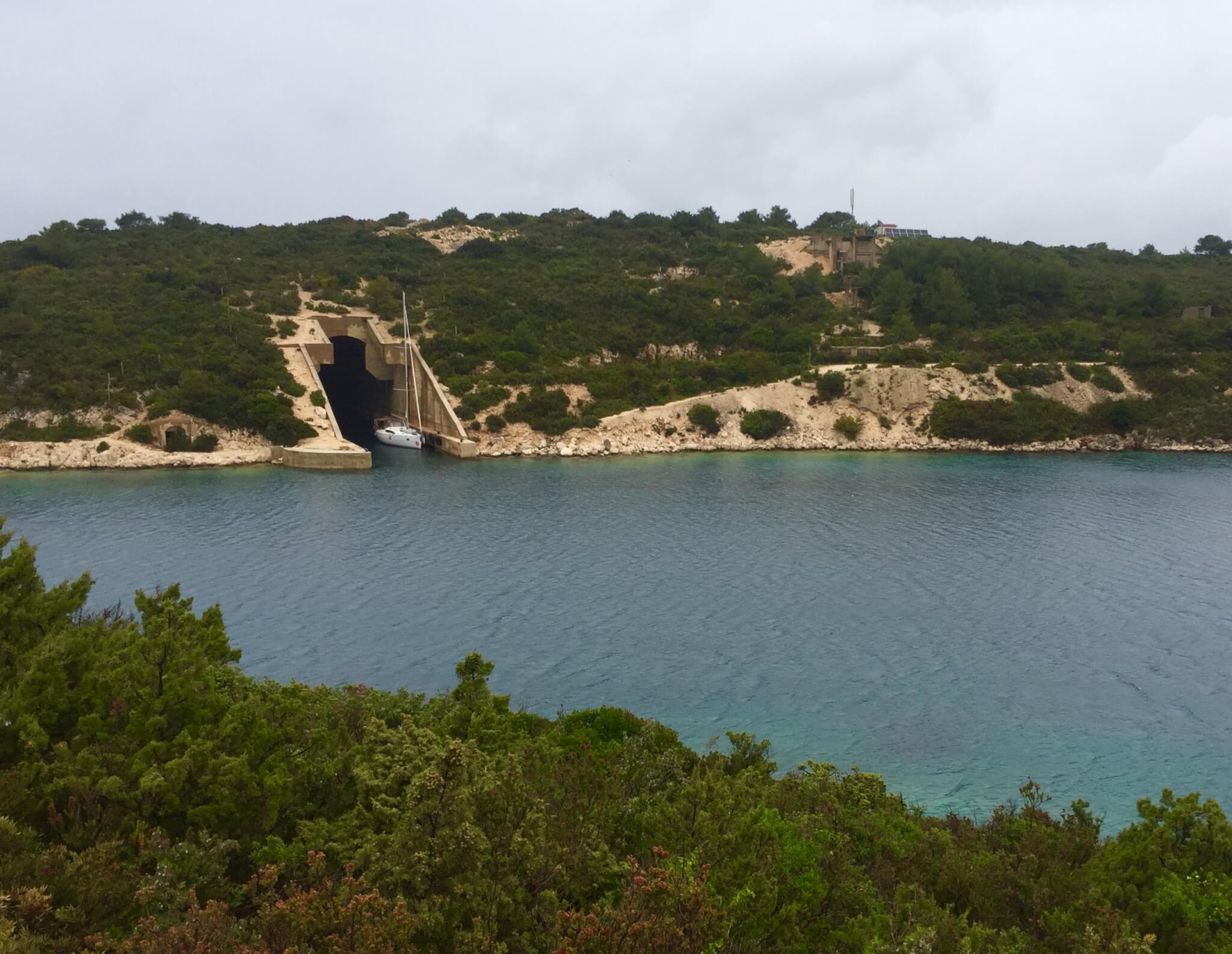
With a little bit of hiking and climbing experience, you can actually climb to the mouth and get into this huge tunnel, which now can be used as a recreational dock.
The waters in the Adriatic sea are among the bluest in the world, and even on this cloudy day this tunnel looks like a big roofed swimming pool. There is just enough room on the narrow pathway to walk around it.
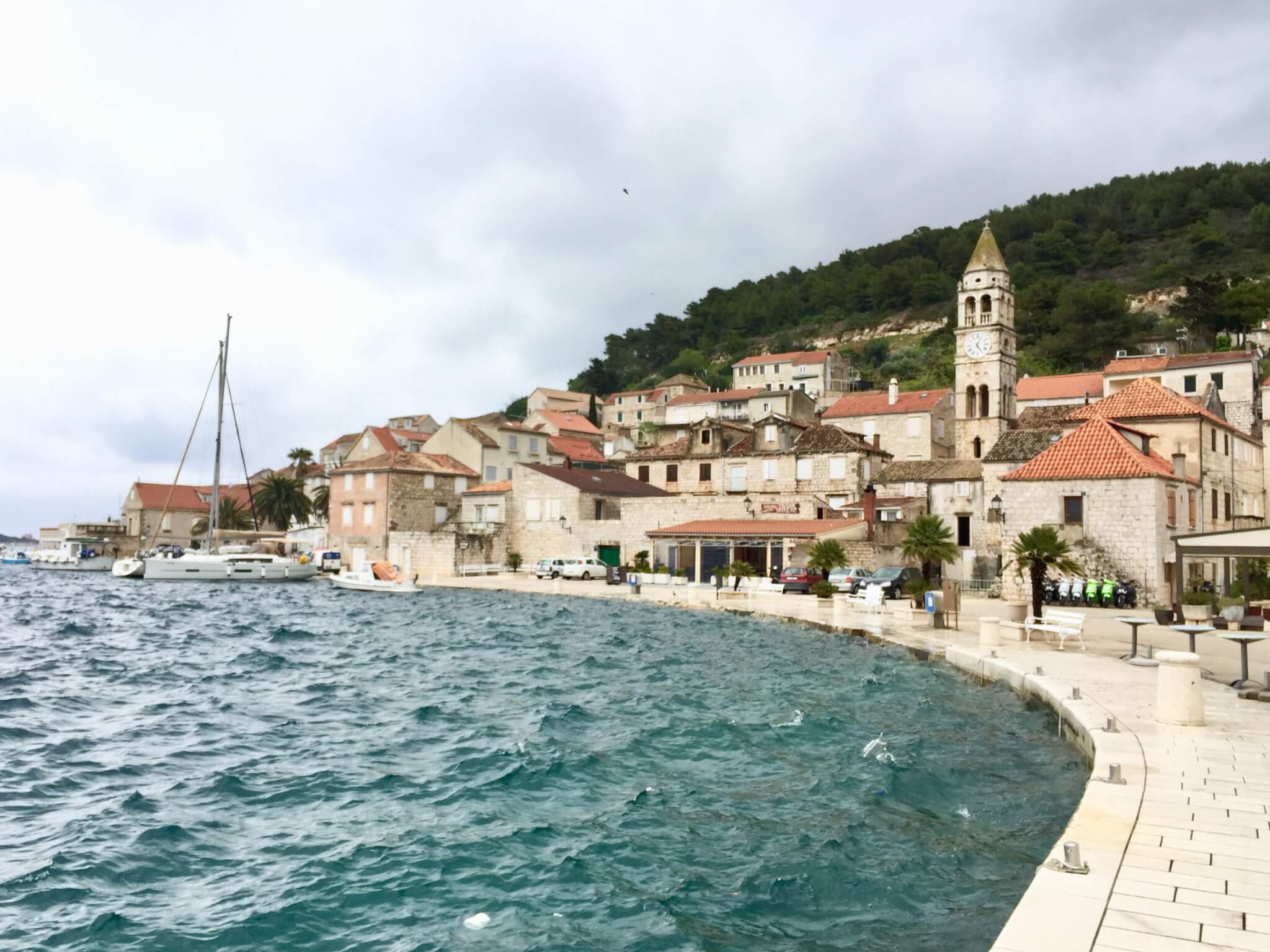
Returning to the town of Vis, I was just in time for my meeting at the tourist office. I made this appointment because I noticed that there’s so little information about the hidden treasures of Vis. For example, how to get to one of Croatians most beautiful beaches, Stiniva beach. On the internet you read multiple times that it is best reached by boat because it is hard to get there on foot. But on my map, it doesn’t seem too far from a secondary road, and because it is such a famous beach, there must be a human made ‘goat’ track to get there. And apparently, there is, which i am gonna find out tomorrow.
Also, it seems hard to find out the exact positions, and the ‘how-to-get-there-information’ of the former military sights. of course these structures have long been forbidden, but that was a while ago. Tour companies claim that most of these places can be seen by booking a military tour, but as it turned out, a couple of them i have already seen coincidentally (the tunnel system near Velika Glava, during my hike from Komiza to Vis, and the submarine tunnel on my hike this morning to Parja bay.
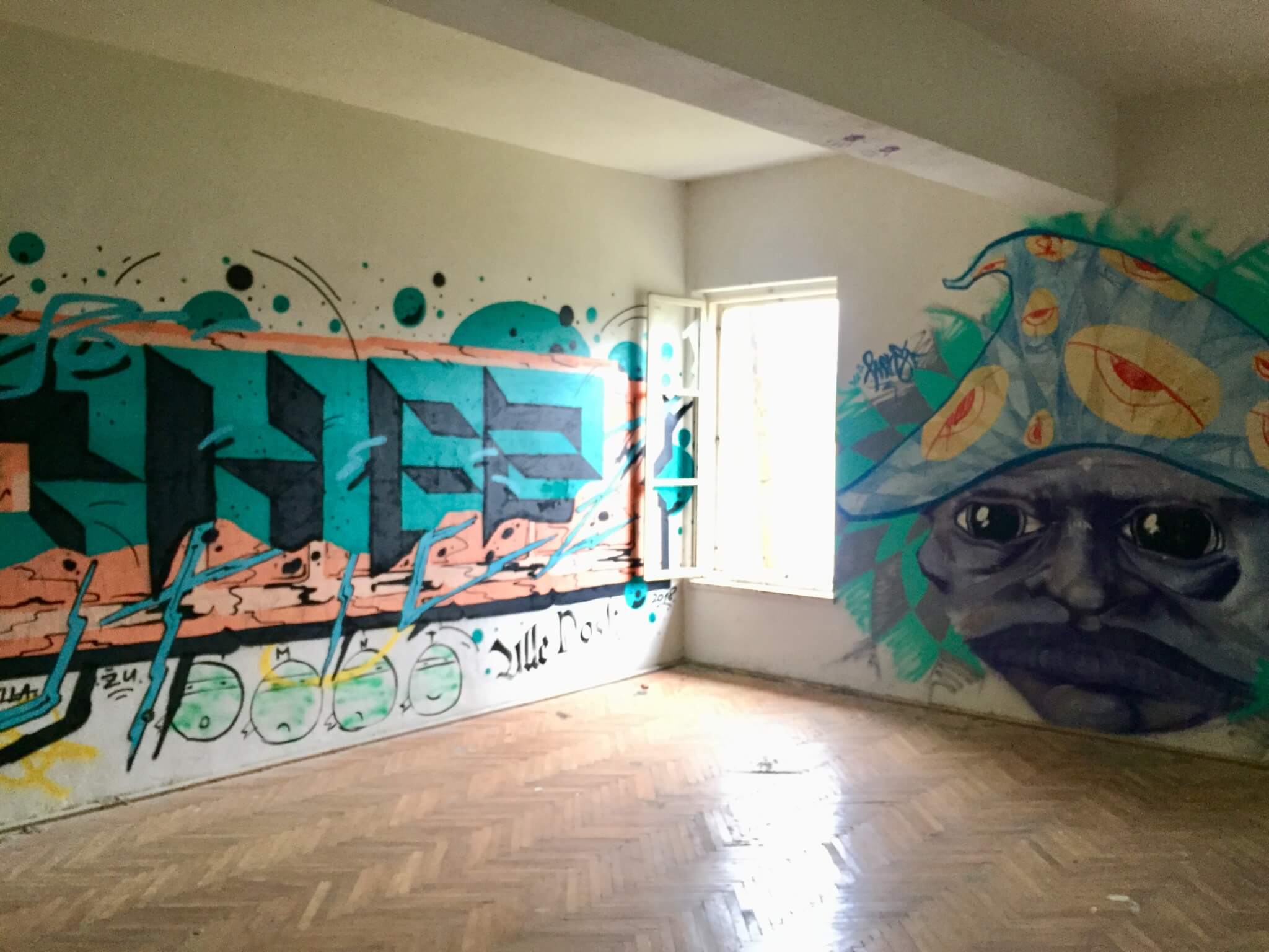
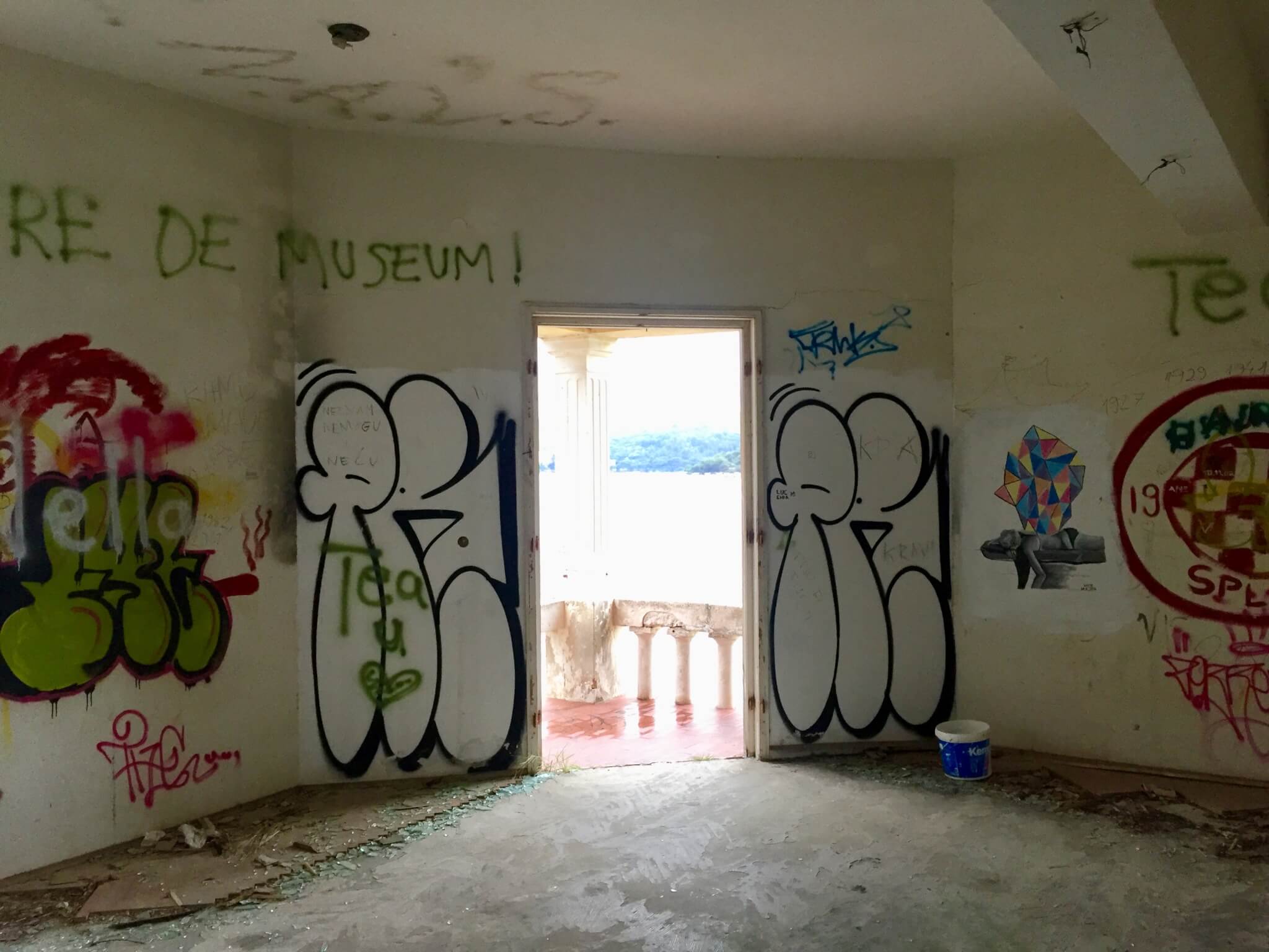
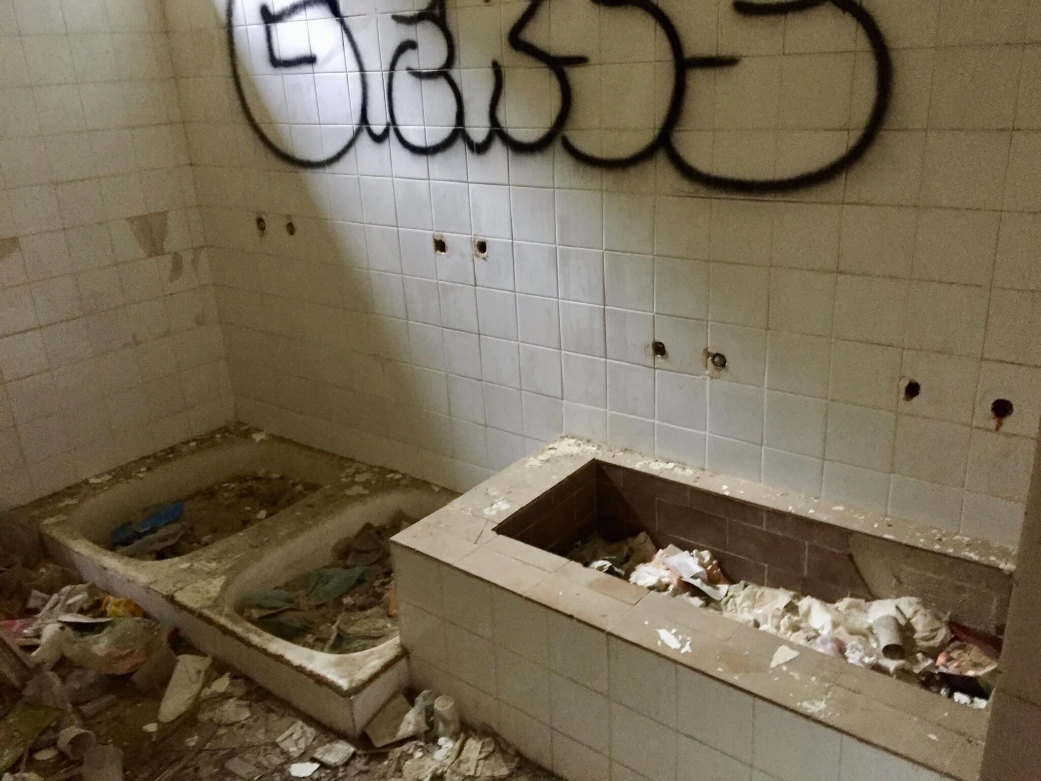
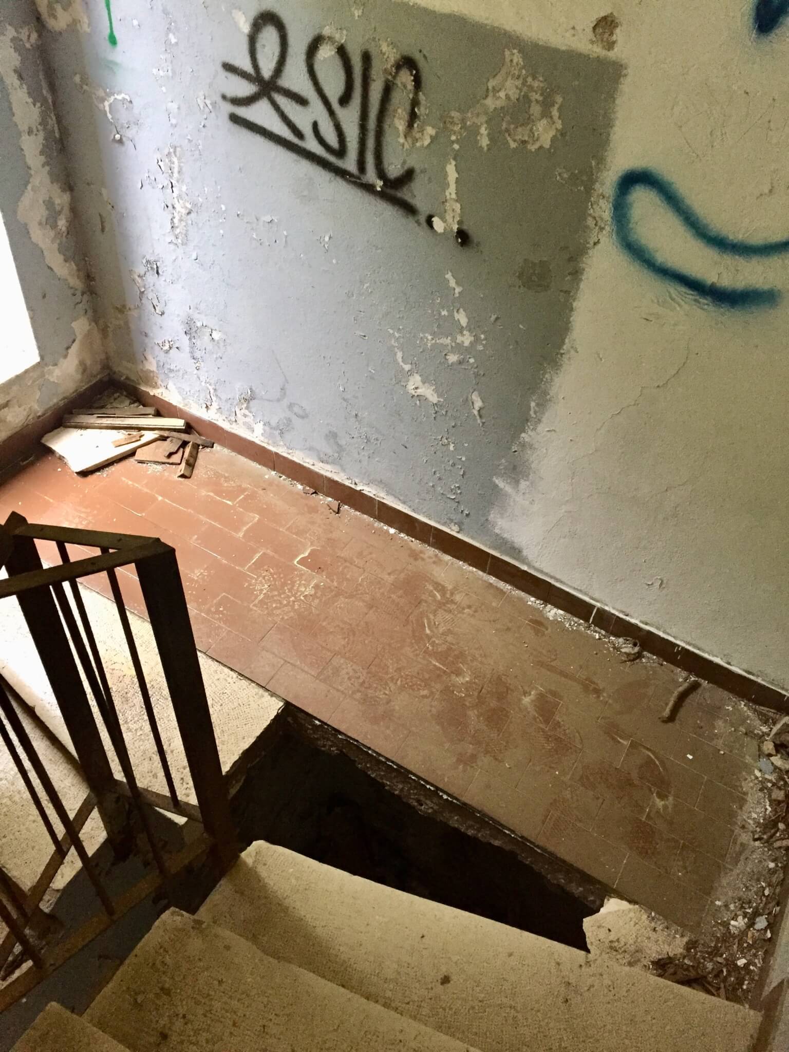
In the afternoon i took a walk on the other side of the bay, passing the old town of Kut (Dutch people, don’t start laughing now…) towards Ceska Vila, an abandoned Villa located on a tiny peninsula.
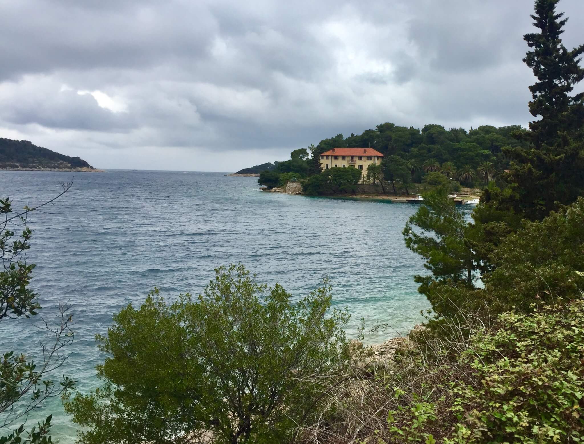
This Czech Villa, as it is named, was build in the 19th century by the major of Vis and was later sold to a Czech family. From the middle of the 20th century it was taken over by the Yugoslavian army to accommodate the soldiers. It decayed strongly and when the army left it was abandoned.
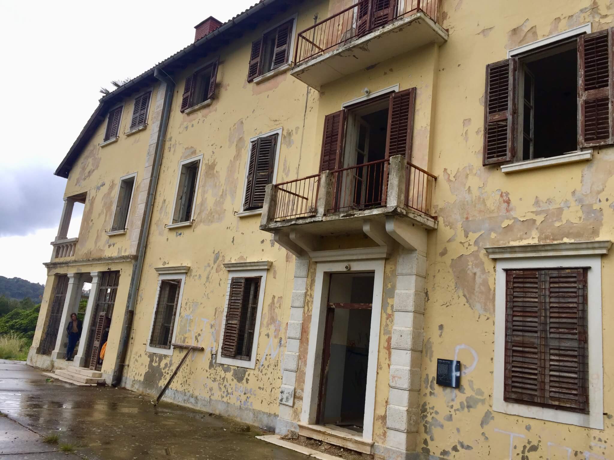
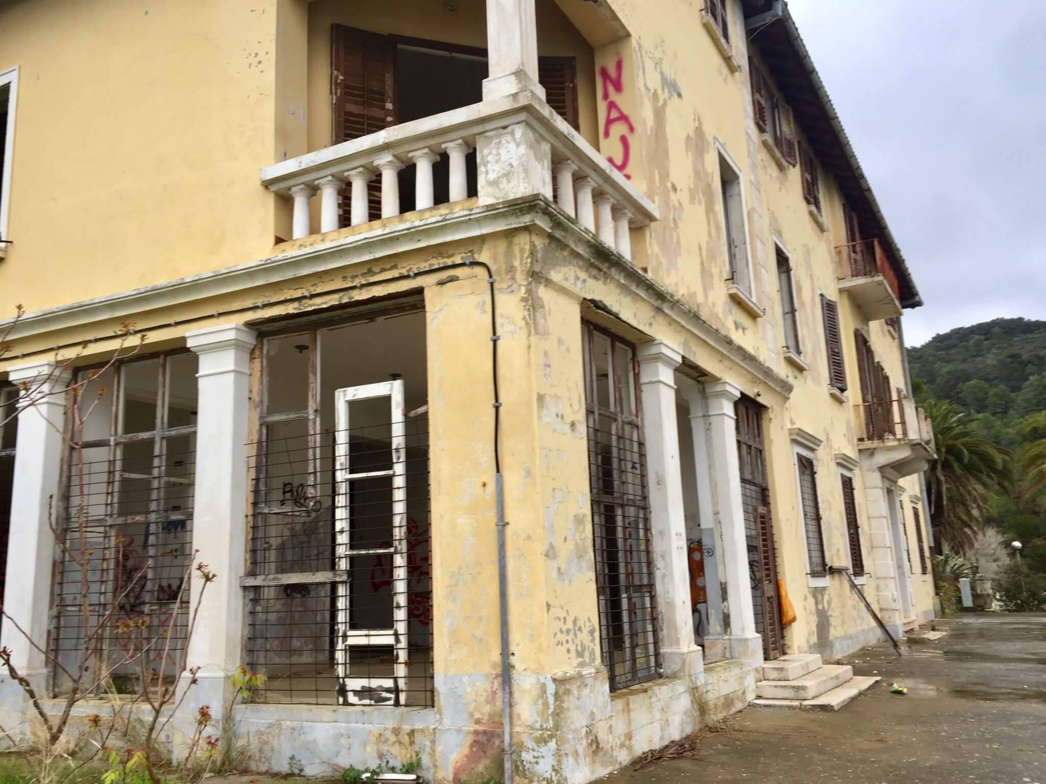
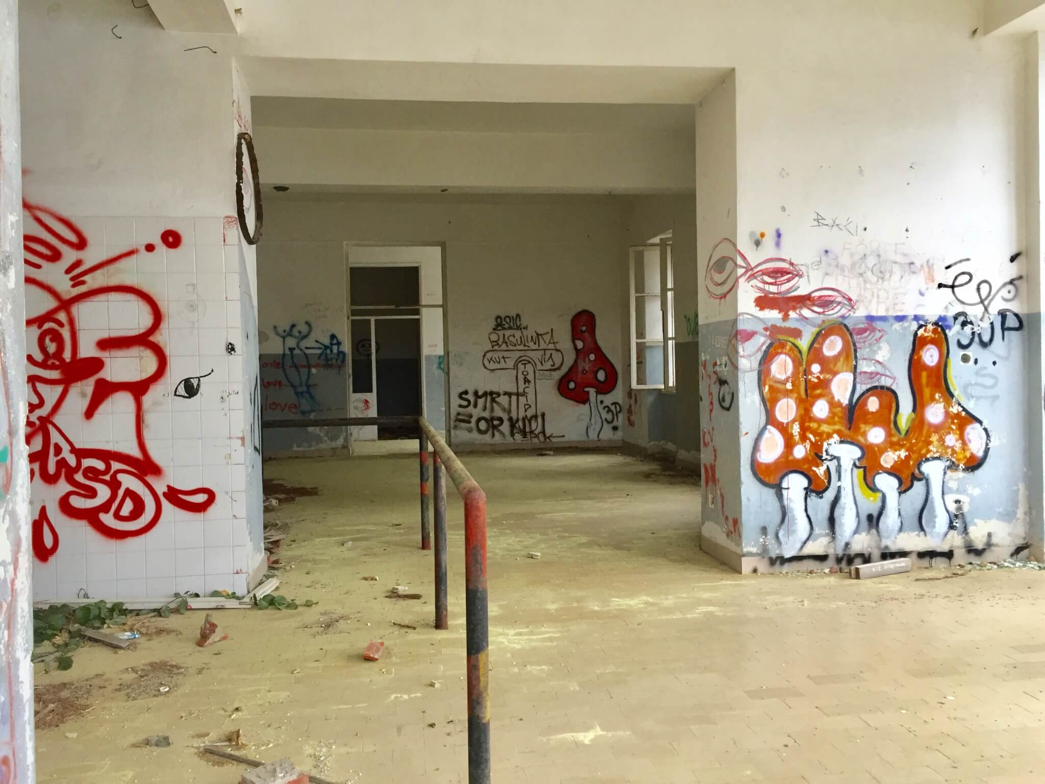
Now it’s more like a piece of art, than a livable space. I read an article from October 2018 that the Croatian government is selling this villa, with a starting price of more than €4 million, but the total investment is estimated around €13 million. And that’s what you start to believe when you see the inside:
Cycling Vis island, the east and the south (9-4-19)
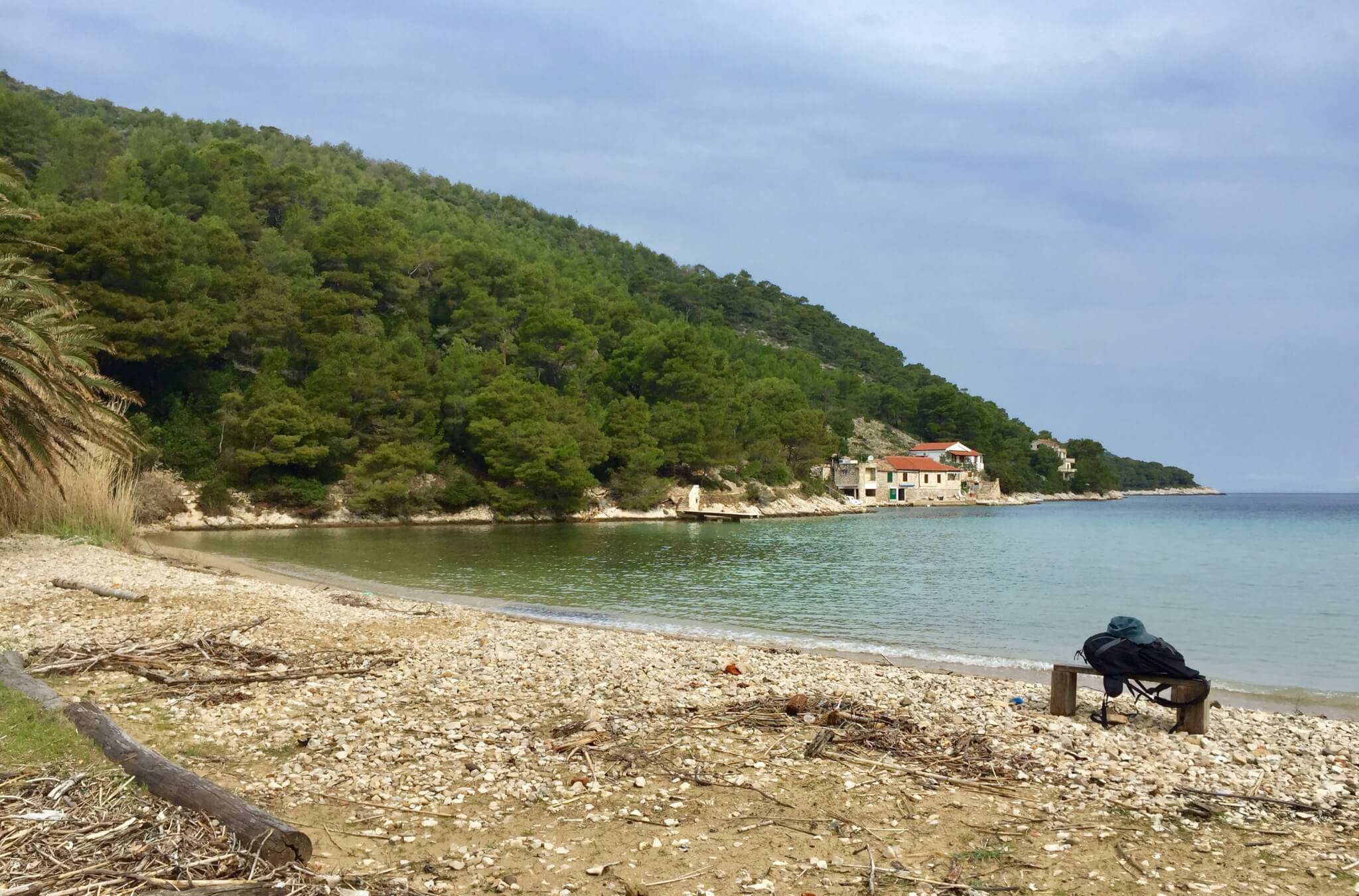
Today is my last day on Vis and i decided to rent a bicycle, to discover the bays on the eastern and southern site of the island. Cycling these parts of the island is relatively easy. It’s hilly, but no high or steep mountains. And with the relative absence of cars at this time of the year cycling is quite convenient. I started with Stoncica bay at the eastern side.
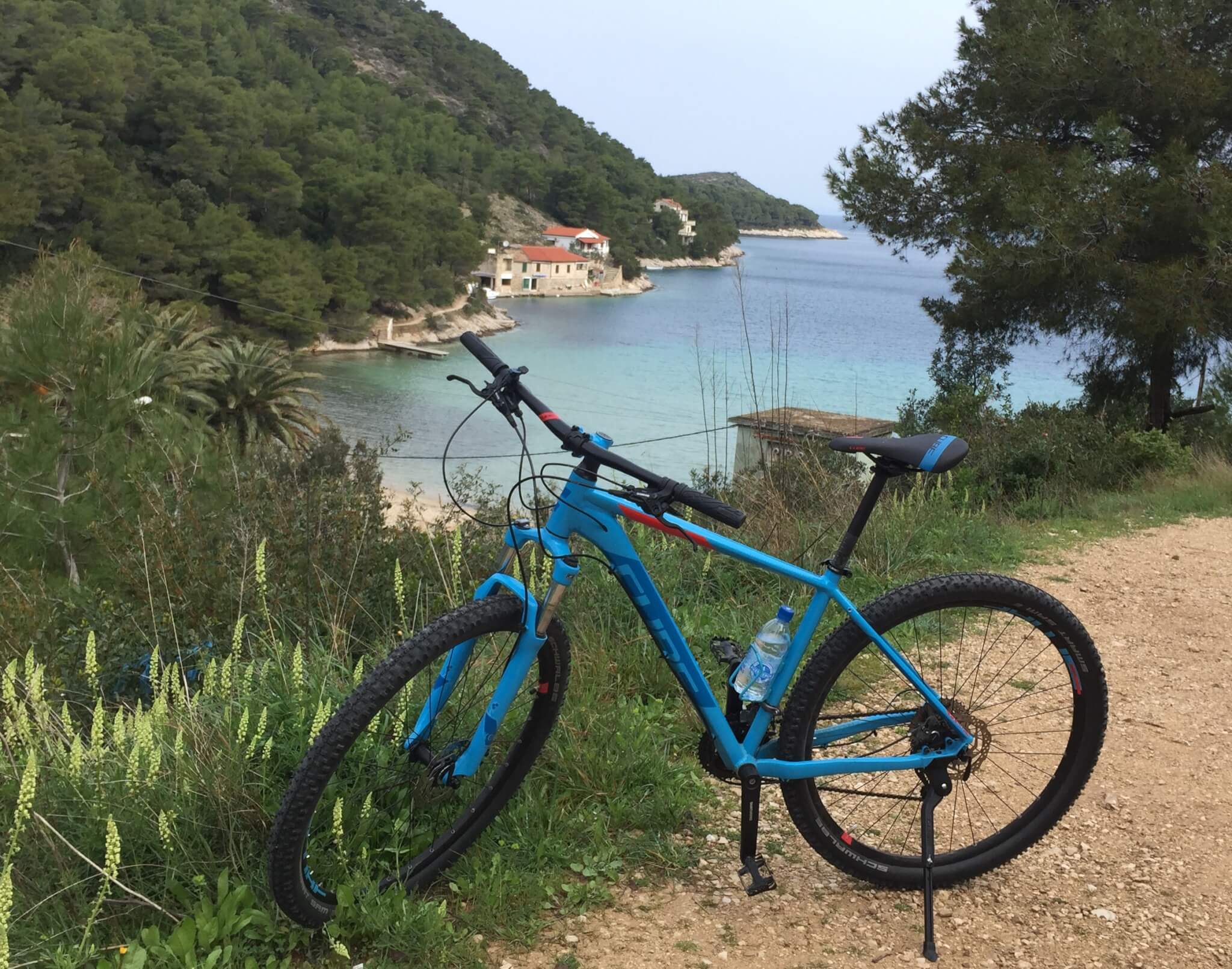
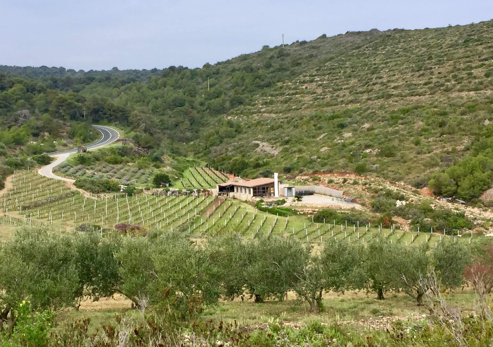
Then, back to the main road, passing vineyards in the interior, towards Milna bay.
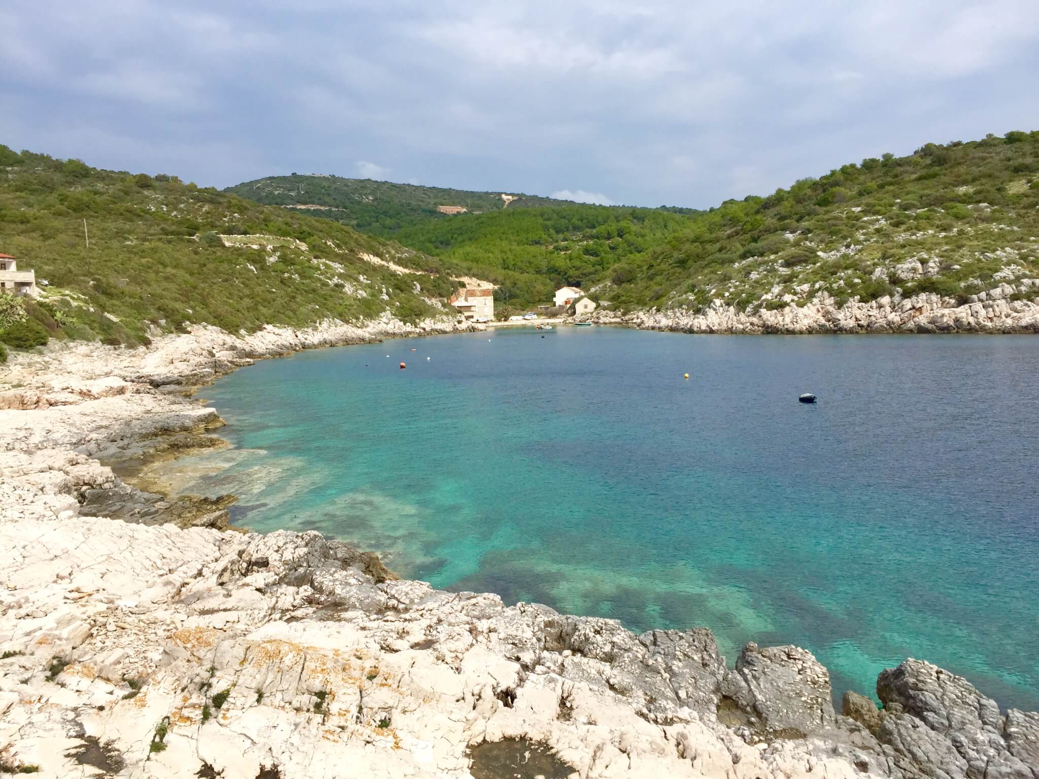
I continued the scenic road, from where you have a good view to a couple of little offshore islands, to Rucavac bay. In this beautiful bay i took a moment to eat my sandwiches which i brought along. This wasn’t a bad idea, because i passed a few bars and restaurants on my trip, but none of them were open. Season starts here at easter, so still about 10 days to go.
My final destination for today, before turning back to Vis town is one of Croatia’s most beautiful and famous beaches, Stiniva Beach. It’s in a cove known for it’s unique natural beauty, dominated by high cliffs that form a small ‘gateway’ to a little pebble beach with clear turquoise waters. The only ways to get here is either by boat or by foot, on a very demanding small and steep hiking trail, which is only suited for the experienced hiker. It takes about 15 to 20 minutes to get down. Definitely rewarding, and i had this little paradise totally for myself!

After this wonderful but tiring (climbing up) experience i got in the sadle again to get back to Vis town, another 11 kilometers from the Stiniva beach parking place. After a bit of climbing i got treated with a beautiful view over Vis bay. Looking back on a nice 4 night stay on this beautiful island.